For the past few months, I've been talking with a friend of mine about southern Utah, and she's talked to me about her husband's cousin, SP, who has lived in the region for a few decades and knows his way around to a lot of Native American ruins. We had arranged with SP to meet up with him last weekend, but it was predicted to rain and be windy, so after a false start, we worked it out for this past weekend. What a trip!
 |
| He's retired now, but he used to run a trading post in the town we were visiting. So in his house, W saw a few items he wanted pictures of, including this cow skull with painting on it. |
 |
| W liked this painting, and the medium on which it was painted, definitely. |
 |
| And we all got in his Suburban and went driving along the roads as he gave us an overview of local history and geography. |
 |
| Scenery along the way. |
 |
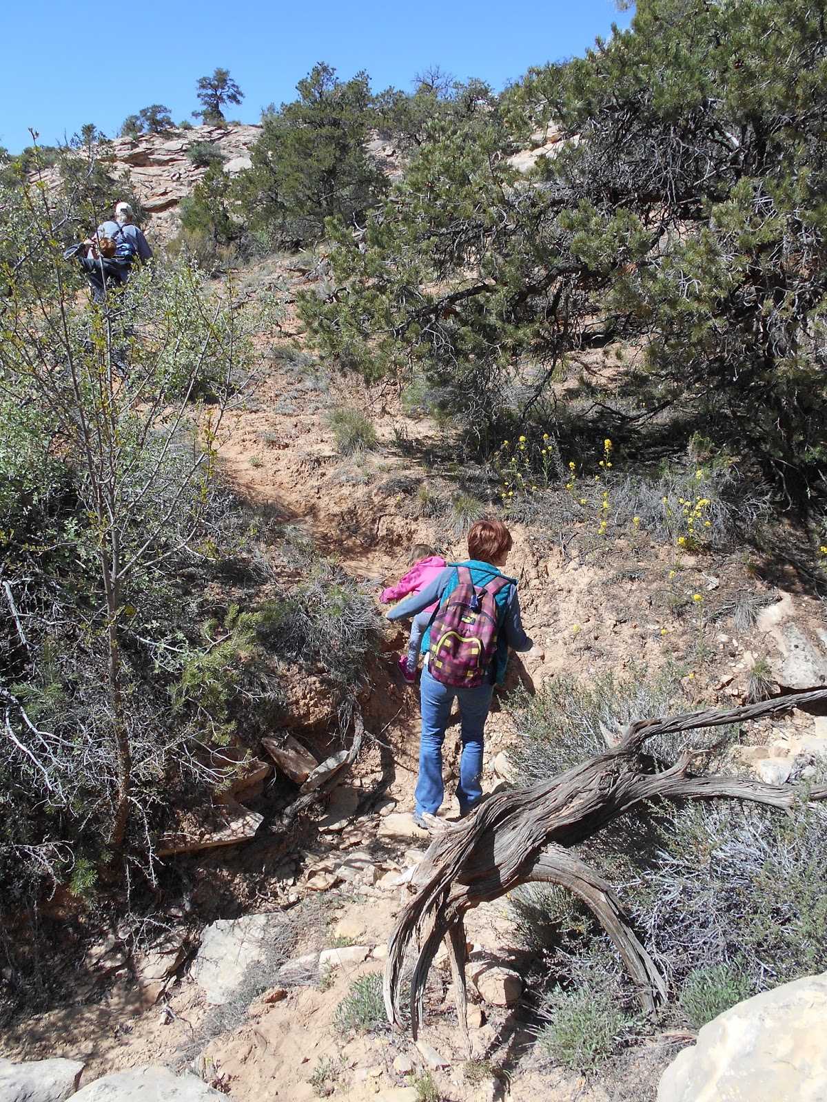
| We got out of the car at a place that looked like this and started walking. When we were setting up the visit, he asked how old our kids were, and I told him how old but that they had gone hiking a lot, and that our 9 year old could hike 10 miles (albeit with a fair bit of complaining). He said, "I'm 72 years old, so we won't be hiking 10 miles." But he was a strong hiker! And we kept up with him. |
 |
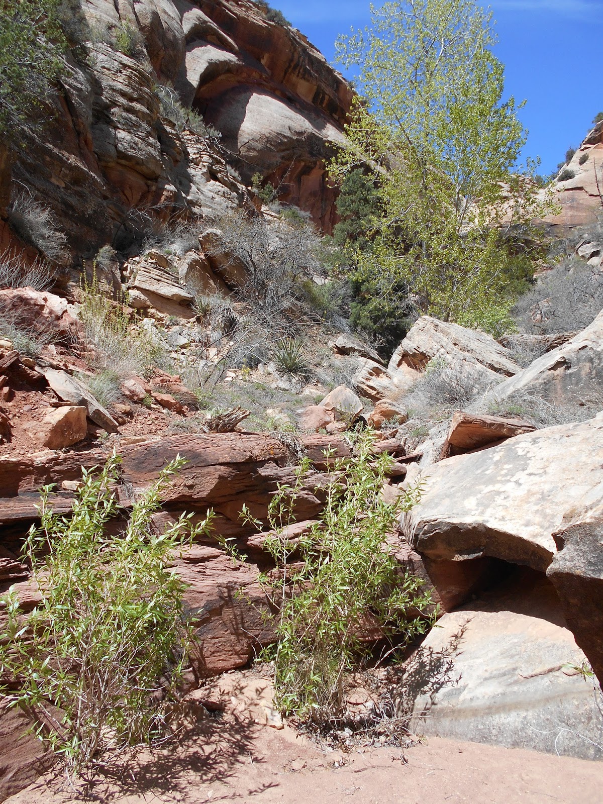
| Down into the canyon we went. |
 |
| Some yellow flowers were in bloom. |
 |
| And some purple ones. |
 |
| We kept on hiking. |
 |
| Some icons of the desert: prickly pear, yucca, slick rock, hoodoo, and clear sky. |
 |
| Down past some bathtubs in the rock. |
 |
| Here was a hole in the rock ground. With several natural stone marbles in it, washed there by floods and rounded by spinning around in the hole in the water. And the hole gets worn deeper by the spinning marbles. I wonder how many years the longest-term resident marble has been in the hole? |
 |
| We kept on going down the canyon. |
 |
| It was in the 60s for temperature. Just in the zone where a tshirt works if the sun is on you and the wind is mild, but a long sleeved shirt and more works if the wind is strong, as it often was. Here's enjay in the wind and the sun. |
 |
| The Oregon Grape was blooming yellow |
 |
| Finally SP stopped and asked the kids if they could see any ruins. They did, through the trees, once he pointed. |
 |
| We went on hiking toward them |
 |
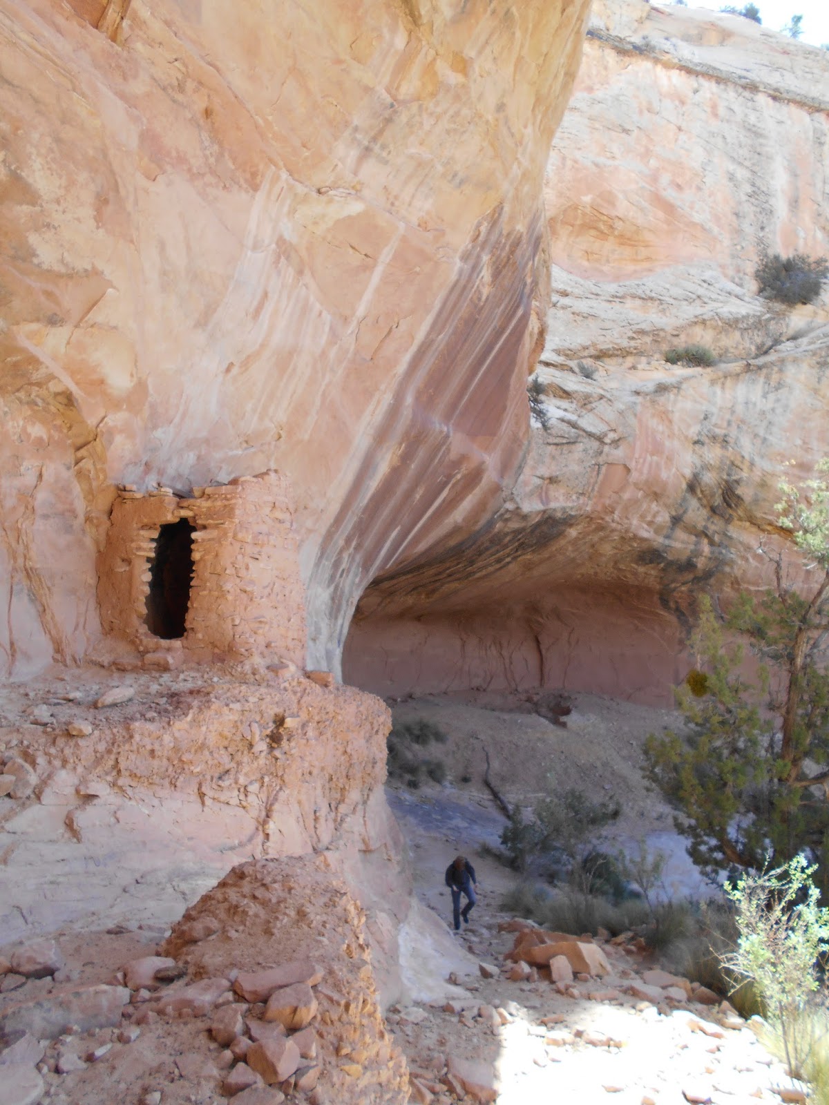
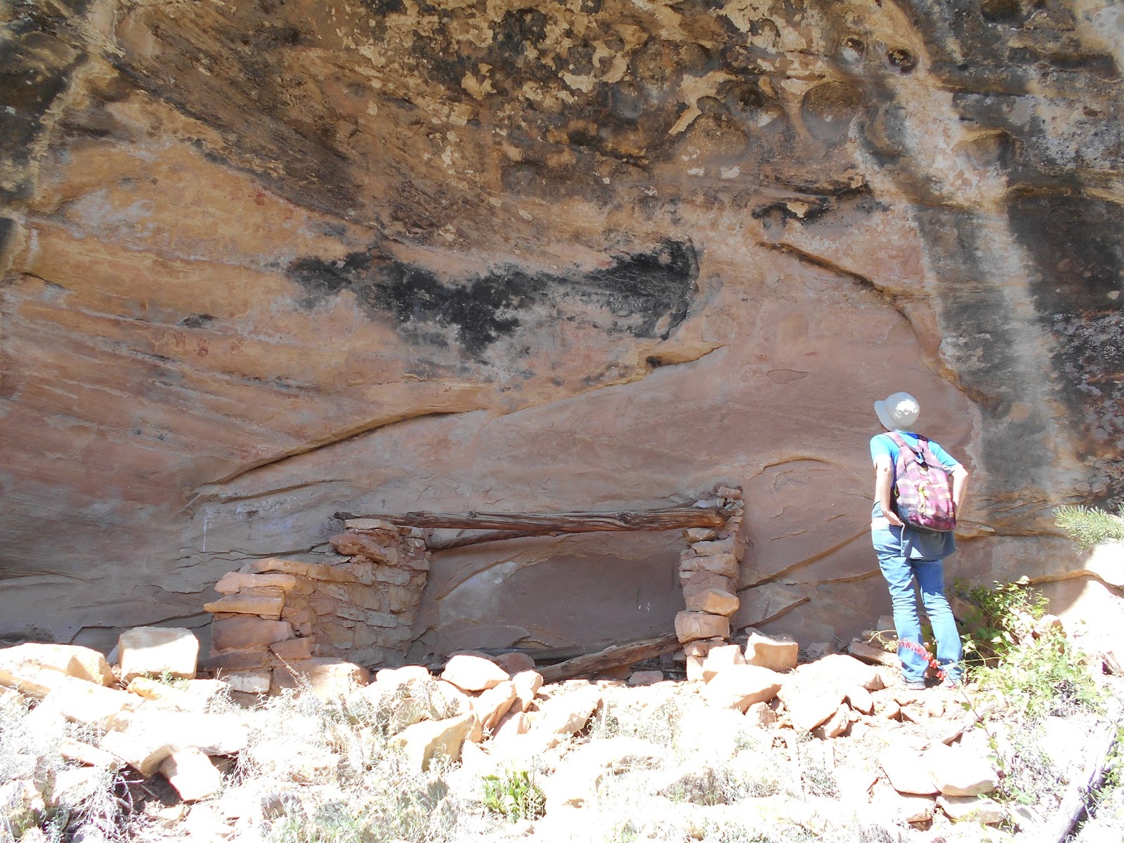
| And in the alcove, we saw the ancient masonry work. |
 |
| An impressive rectangular tower. We've been to Mesa Verde but I've wanted to see what these ruins are like when not reassembled by the National Park Service. This building in front of S was in remarkable shape. |
 |
| I stuck my head inside the rectangular tower and looked up. |
 |
| SP started pointing out the petroglyphs on the walls. (Petroglyphs are carved or pecked while pictographs are painted.) He made sure we saw that the main figure has another figure on its shoulder. He suggested this was a wild turkey, since that's a common figure in the drawing in these parts. |
 |
| I wanted to get a close up of the stonework, thinking I might try painting some of it (in watercolor at home--not actually painting on the rock). SP says that in the heyday, the rocks would have all been covered by mud/cement plaster. |
 |
| Looking up the wall |
 |
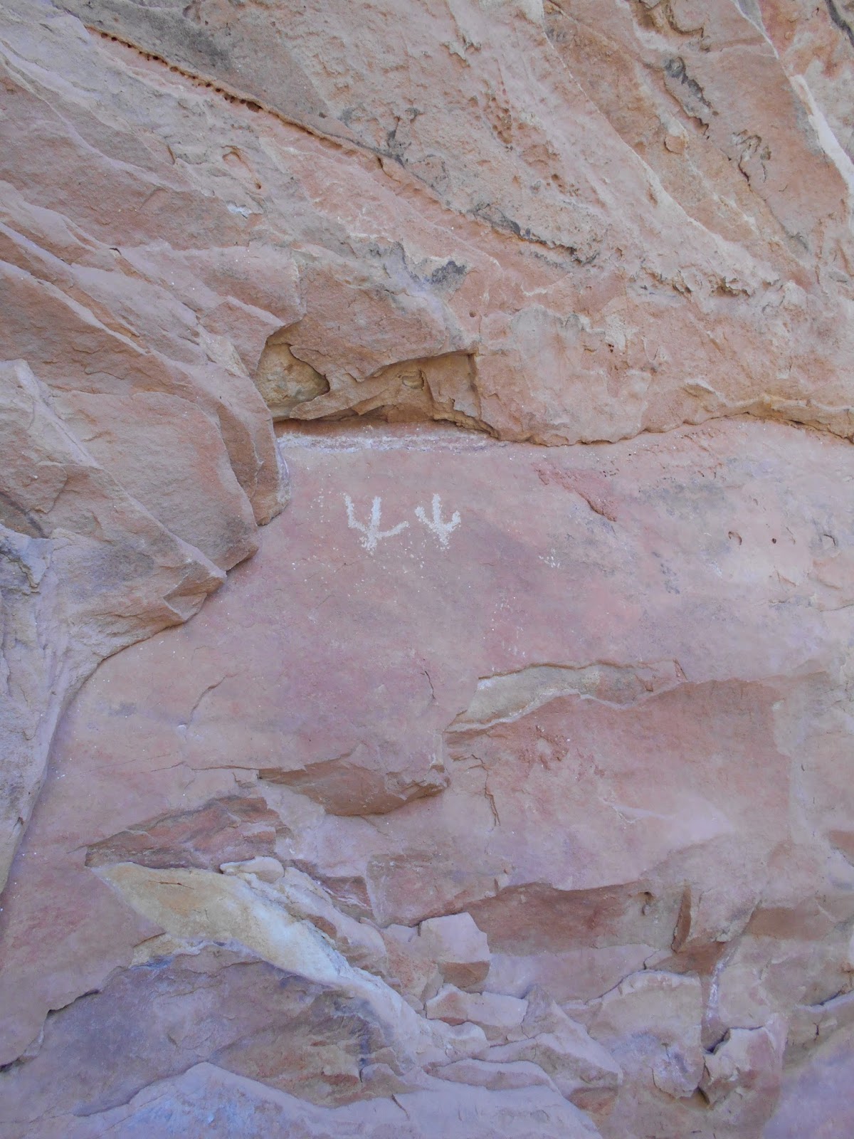
| SP suggested these were drawings of turkey footprints. |
 |
| It's hard to imagine the centuries this masonry has held together. |
 |
| Looking in at the floor of the rectangular tower, with ample animal droppings on the ground. |
 |
| Looking among the detritus on the floor of the rectangular tower, W saw what looked like a laminated piece of paper and pulled it out so he could read it. We're glad the government has passed laws to protect places like this. And of course, places like this are isolated enough that it also depends on the good faith of the people who visit. Certainly a lot of these places have been looted, and if we were stumbling on this ruin 200 years ago, we probably would find in tact pots and possibly sandals woven from yucca fibers. But those were taken by people who had a different idea of preservation (preserve by museumizing or keeping on a shelf in your house, or by setting the pot on your kitchen table to put flowers or beans in). It's a different world of ideas on preservation today, fortunately. (But maybe this idea of "a different world of ideas on preservation today" is overly optimistic, given what I find on ebay when I search for anasazi pottery.) |
 |
| Looking in the window with the flash catching the dust in the air. |
 |
| Within a few minutes of arriving, W came over and show me a piece of a broken pot he had found sitting on top of the dirt. SP said he would take us to a place where we would see a lot of other broken pottery, "But I'll ask you to leave it," he said. We were on the same page with SP obviously, glad that someone else had left it for us to see and glad to leave it for someone else to see. |
 |
| I looked down after W put his pot fragment back and saw a piece of corrugated pot fragment. SP said that the corrugations were a late innovation, possibly having a function for temperature, like a radiator. |
 |
| I looked down and I was standing next to a big boulder where they used to grind. W asked if they ground corn here but SP thought it was probably a place for them to shape their "manos" or the stones that they used in the metates. |
 |
| S is looking at (not touching) the petroglyphs. |
 |
| The ruin site was under an overhang, and the top of the overhang was the floor of a canyon that, when it rains, dumps water in a pool at the base of the ruin site. |
 |
| An old mortered and masoned item? |
 |
| Marks where items were sharpened. |
 |
| On top of the sand, W found a corn cob, hundreds of years old, and considerably smaller than the corncobs we know today. Preserved in the dry climate and dust. |
 |
| SP showed us the indention left by a kiva, which when it was used (for ceremonial purposes I think) would have been an underground room with a wooden roof. |
 |
| On the kiva wall, W pointed out a piece of pottery. I thought he had moved it there and said to be sure he put the pot fragments back where he found them. He said it was lying right where he found it. |
 |
| The pool at the base of the ruin site. |
 |
| We looked around a last time, trying to take it all in, and then it was time to go. For other day, SP said, there are other ruin sites along the canyon. |
 |
| Scenery from the hike out. |
 |
| I'm posting most of the pictures I took since enjay and I might paint from some of them, and we don't know which ones yet, so it's for our convenience. |
 |
| Looking back at the ruin site, you can see the canyon above the alcove, ready to dump more water next time it rains. |
 |
| Looking back. |
 |
| Getting back to the Suburban. SP drove us to a lookout place where we could see a long comb of earth and rock, and the valley it towers above |
 |
| Someone had made a bench at the overlook. SP said once he came up here and camped with 11 people in their teardrop campers. |
 |
| If you click on this pic to made it larger, you can see the comb of earth jutting up into the misty distance on the left side of the valley below. |
 |
| Looking directly across from the top of the comb. SP pointed to the canyons flowing out of the rock and said they're all interesting to walk through. |
 |
| According to the weather report, the wind was going at 20 to 30 miles per hour, with gusts of up to 50 mph. So the clouds were moving fast across the sky. As this shadow passed over the valley, I turned my camera on and got the shot taken just in time, before it made its way to the other side of the valley. |
 |
| Then we drove for awhile until we got to a hill that was covered in what SP called "ruin weed," a plant that he says frequently grows on places where there are old settlements. |
 |
| As soon as I stepped out of the car, I saw potsherds at my feet. |
 |
| And a rock that wasn't an arrowhead but looked like it might have been a candidate for making into an arrowhead. |
 |
| As we walked just five feet in any direction here, we found (and then replaced) potsherds that were sitting on top of the sand. I was fascinated by this one, which still had traces of paint and design. |
 |
| Within three minutes, W called me over to take a picture of some shards he had found and was about to put back. I no longer thought the "traces" of design I had seen were as impressive! |
 |
| SP showed some crosshatching design. |
 |
| A close up of a small red bug on a potsherd. |
 |
| Enjay among the ruin weed. |
 |
| SP pointed to stones that I would have just thought were lying naturally and said they were from old structures. |
 |
| We walked off the hill, and the dirt was still littered everywhere with potsherds. |
 |
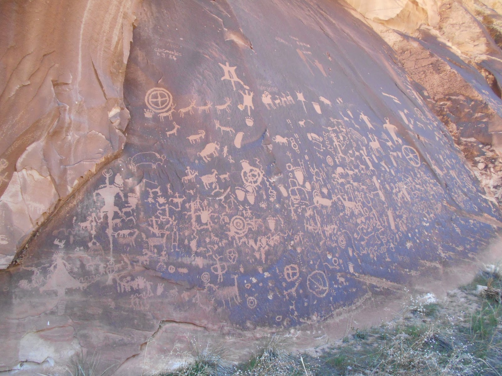
| SP stopped and pointed out that we were walking in a depression in the ground, and that it was hard to see but if you looked left and looked right you could see that there was a rise of about four feet on either side. He said this was part of one of the Great Roads, which lead to Chaco in New Mexico, the old center of the network of civilizations. |
 |
| One edge of the Great Road, hard to get a pic of. |
 |
| W had a real eye for finding potsherds with nice designs. He pointed out the design along the lip of the old pot. |
 |
| I liked the dots on the uppermost shard here. |
 |
| Enjay found some read and black glazing. |
 |
| W found several pieces, one with a hole in it, drilled anciently maybe to make into a pendant, or maybe drilled so they could stitch a favorite pot back together after it broke. |
 |
| Then he flipped it over and we saw there were two holes drilled in it. |
 |
| If you click on this one, you'll see some intricate lines from the glazing technique. |
 |
| A sign warning against "destruction, defacing, vandalism, and theft of archeological and historical resources," stating that it these things are punishable by law. As we said to the kids, we're glad that other people have left these things for us to see, and glad to leave them for others to see. |
 |
| As we drove off, SP pointed out a uranium mining set-up from sometime in the 20th century. (He mentioned early century and mid-century mining in the area and I don't remember when these ruins are from.) |
 |
| As we drove along, SP mentioned that he goes sailing sometimes in a nearby lake, and I was impressed and he got to talking and mentioned that just last year he had sailed from Florida to the Bahamas in a little boat he's got in the yard back in town. It was hard to imagine someone who knew so much about this area also knowing some much about sailing that he would take a little boat out on the high seas. I would think either would require so much specialized knowledge that you wouldn't have time for other things. But I guess I'm wrong. |
 |
| Ate lunch in the car while it rained and while the wind blew dust devils all over the place under the dark clouds. I wondered if things would ever clear up or if we would have to go back to town. But after 30 minutes we got out of the car and walked along a new trail under this clear blue sky. |
 |
| We came to an overlook where we could see two alcoves, one on top of the other, both with ruins. SP said there was currently no way to get into the top alcove, though the Native Americans must have used a very long ladder to get up from the lower alcove, for a rope to lower themselves from the cliff above the top alcove. SP repeatedly talked about the sites as being "defensive," imagining that they were set up to be able to defend themselves from attackers. He told us about a site he's seen that's designed to have just a narrow path as the only entrance, and then there's a wall along the narrow path with holes in it, spear holes, so that defenders could deter (or kill) unwelcome visitors. He said, "That's the most defensive site I've every seen." |

 |
| A closer view, from across the canyon, of the upper alcove. SP said once when he was over above the alcove, he saw a car axle that had been pounded into the rock so that someone could let themselves down by a rope. But he said he's gone there again and never been able to find the axle on subsequent visits. |
 |
| We were on the other side of the canyon, on the top of the opposite canyon wall from these alcoves, so it was time to descend. |
 |
| Down we went. |
 |
| Once we got to the bottom, we walked along the mostly dry creek bed, dodging the occasional puddle as we went. |
 |
| Then it was time to climb up the other wall, to the lower alcove. |
 |
| SP said that when he first found this ruin, he had been walking along the creek bed, and he didn't realize there was another set of ruins in the alcove perched above this one. He didn't even realize there was an alcove above this one. He didn't know until he left, hiking up out of the canyon to where we were looking at the two alcoves. |
 |
| Most of the ceiling was black here, as if there had been a fire all throughout, or a lot of fires running in different places. SP said this was a curious place to build a shelter, since the Native Americans of the era looked for south-facing alcoves. In the summer, the sun is directly overhead, so the overhang protects from the summer sun. But in the winter, the sun has an east to west arc like in the summer, but the arc doesn't happen directly overhead. It takes place to the south, so if you have a shelter in a south-facing alcove, you get more sun to help you stay warm. So, since this alcove isn't south-facing, maybe they needed more fire and hence the greater blackness on the ceiling? (I think I got all that written down correctly, but if there are errors I'm sure it's my misunderstanding and not SP's explanation to blame.) |
 |
| On this building, you can see the plaster covering the stones in places. |
 |
| Looking back at this picture and the next one, I've been confused about why I took them. But now that I'm thinking back through the pictures and the trip sequentially, I remember I took these two to show all the rodent droppings that are sitting on top of one of the structures. I don't know how thick they were, but an accumulation like this would take years I imagine! |
 |
| This was an interesting scene because of the way the top of the wall so obviously followed the exact contour of the alcove's ceiling. And yet the top of the wall was two or three inches below the ceiling. An engineer would know more about this than I would, but I think it shows how the floor and the ceiling of the alcove have shifted geologically since the wall was built. |
 |
| To me, this wood and mortar platform, suspended above the ground, seemed really intriguing. As you'll see in this picture and the next few, several pieces of wood are set on crossbeams that were built into the wall, and then the wood was covered in plaster. Today, at the edge, the splintered ends of the sticks are showing and seem like they're only precariously resting on the crossbeam. How long until it falls? Ten years? Five years? Two? Sad to think of it falling after centuries here in the alcove. |

 |
| See how some of the beams are only holding onto the crossbeam by their terminal splinters? But the deeptime we're talking about with this platform, which is maybe 1000 years old, is nothing compared to the deeptime of the stone, the size of two fists, that SP has at his house, which he says is a stone that was rounded and shaped in a dinosaur's gullet as an aid to digestion (like a bird will swallow pebbles today). And that deeptime of the dinosaur-gullet stone is nothing compared to the deeptime of the stone before it was shaped in the dinosaur gullet. (Speaking of deeptime, I've been watching some videos about the Webb Telescope that's supposed to be launched in October 2018, and they keep saying that the universe is about 14.5 billion years old. That seems like some deeptime, until I remember that the Earth hosts one human for every two years of the universe's existence; and that a human lives to an average age of, say, 70 years. And so if you add up the life spans of just the humans living on the earth today, you've got 490 billion years. So the lifespans of just the people living today--just this small slice of time that's a blink of an eye in geological time, as they say--amounts to about 34 times the entire age of the universe. All of a sudden, given the breadth of human experience just right now, no time seems deep. [They say the Webb telescope will have required 100,000,000 human hours to build by the time its complete; according to my calculations, that's 11,415.5 years, which is at least 11 times longer than this shelf mortared and splintered shelf has existed.]) |
 |
| I imagine someone more recently came through here and stacked these ancient logs up against this crumbled pillar. |
 |
| SP thought this red zigzag might represent a snake. I think this is the zigzag that he also speculated could represent the vase comb of rutting rocks above the valley in the earlier pictures. You remember those pictures? That was just one hundred pictures ago, nothing in terms of the time that's elapsed since the beginning of the universe or since humans started working on the Webb Telescope. |
 |
| SP pointed out these red half-moons that speculated they represent wild turkeys. |
 |
| A hand in positive relief and a hand in negative relief. The positive hand was made by putting the hand in paint and making a print on the wall. The negative relief was made by putting the hand on the wall and blowing paint onto the hand and wall and then removing the hand. I just think about all the red dirt I would need to put into my mouth if I wanted to make a negative relief hand print somewhere. |
 |
| And here are more marks of grinding. |
 |
| If you look closely you can see some positive relief hand prints. |
 |
| I liked the swirls on the ceiling here. |
 |
| Looking out of the alcove. |
 |
| At the base of the alcove there were some yuccas fixin to bloom. |
 |
| Looking back at the ruins, trying to take it all in before leaving for the next site. |
 |
| At the sunny edge of one corner of the alcove, a cactus was blooming. |
 |
| It was time to go but we lingered still, W sprawled on the floor, looking like Christina in Andrew Wyeth's 1948 painting "Christina's World." |
 |
| So while we lingered I looked more closely and decided to take a picture of a spiderweb that formed a tunnel coming out of the rock wall. |
 |
| A few potsherds. |
 |
| And we hiked down the canyon to the next site. |
 |
| This one was smaller, less built up. |
 |
| SP suggested this petroglyph might be a representation of a corn stalk. He also thought it could be a ladder. |
 |
| SP offered to take our picture here. I stood back so we wouldn't obscure the wall. |
 |
| Sharpening marks. |
 |
| On the floor, a rock that reminded of Utah. |
 |
| A cornstalk? |
 |
| Some shaped pecked into the rock wall, pointalism. |
 |
| Enjay offering some speculation on a glyph. |
 |
| It was time to leave this site for the next, and as we walked away I took a picture of one of the many shards that dotted the dirt as if they were regular rocks. |
 |
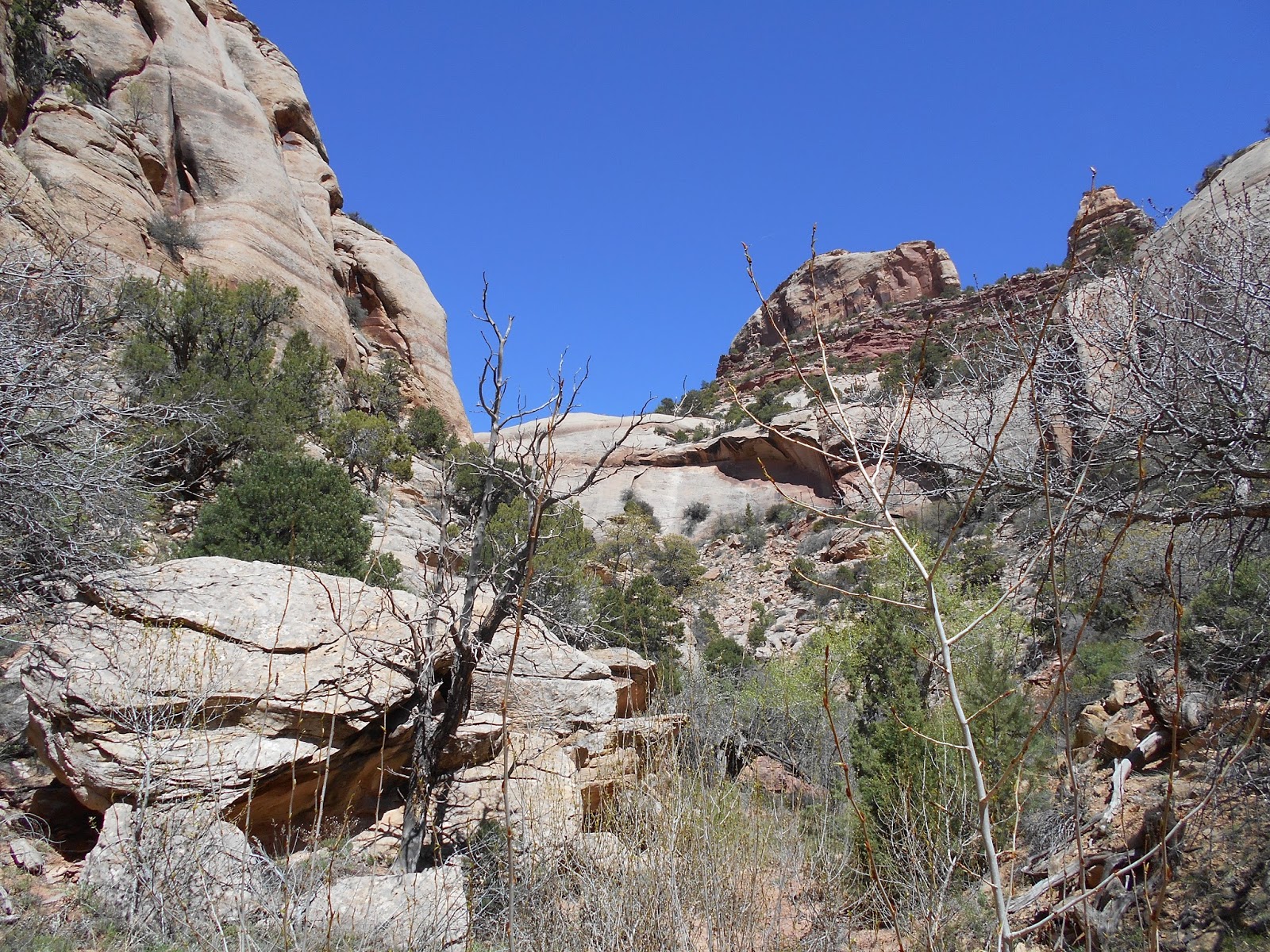
| After walking along the bottom of the canyon we climbed up some steep places. |
 |
| Looking down toward where we had come from. |
 |
| And looking forward toward another alcove. (Strange thing was that now that we had seen so many ruins in the alcoves we were visiting, we had a hard time imagining that there would be an alcove without ruins.) |
 |
| This cactus was growing and blooming in a small glob of dusty soil, set on the solid rock, held together by cryptobiotic crust |
 |
| Ruins in the alcove, with nice stripes of desert varnish as seen in the next few pics. |
 |
| Some details of the masonry. |
 |
| After that alcove, we started climbing up out of the canyon, going a different way. I liked this scene--no soil, but a tree growing in the crack in the rock ground. No petroglyphs but the desert varnish making patterns on the wall like it was trying to inspire pottery designs. |
 |
| During the steeper portions of the hike, it was remarkable how SP's presence and coaxing gave S courage to climb places she wouldn't normally climb. And it was remarkable how SP's directions to W to "help your sister" convinced W to stop and help S in ways that he's not usually inclined to do. |
 |
| If you look at SP's feet, you can see that he and the kids were stepping in "moki steps," footholds cut into the rock face centuries ago by people who needed to climb here. And still useful as steps today. |
 |
| A good pic of Enjay shimmying up the moki steps in the foreground. |
 |
| Now it was my turn to climb up the moki steps. |
 |
| We made it to the top! |


 |
| We left SP's house at about 9.30 in the morning, and now it was 4pm. But before we went back to his house for dinner, he drove us up to a higher elevation area so he could check for snow, since his fiancee's son was coming next weekend and he wanted to take him to a ruin site that was on the side of a cliff up there. No snow to be seen. Then we headed back down to town, where his fiancee, D, had prepared a dinner of enchiladas for us. She would have come on the expedition but she had broken her arm on an ATV six weeks earlier and was still healing, even if the cast was off. She was so kind and fun to talk to, and since she's just retiring from being a chaplain for hospice in a nearby state, we had a pretty candid and inspiring discussion of religion around the table after dinner. I should also mention that we had planned on camping but while we were driving back for dinner, SP generously invited us to stay the night at his house. W was on an air mattress, S was on a couch, and N and I were on a sofa bed. All so much more comfortable than camping and so unexpected! |
 |
| D is just moving up to Utah from another state, and among the few of her things that are at SP's house is this painting, which she saw me eyeing. And i was eyeing it because I'm interested in painting cactuses. I've see paintings like this online, but it's different to see them in person, where you can see they're so big. |
 |
| S says she loves the work of Vikki Reed. |
 |
| The next morning before we left I took a few pictures around the back and side yard (the front yard is a parking lot since the home is built as a business in front and a living space in the back). |
 |
| To get into the back home area, you walk through a gate with a shed surrounding it full of firewood. |
 |
| Here's a plant on the right with a kind of flower NJ likes, especially the smell of. But right now I can't remember the name, so I'll let her mention what kind it is when she sees this pic. |
 |
| The desert produces all kinds of interesting shapes of wood. |
 |
| After breakfast in the morning we headed off for church at 9 o clock. |
 |
| Then we drove to the next town north and headed up into the mountains, stopping by this reservoir and seeing a Brewers Blackbird for the first time ever (that we know of). |
 |
| We stopped at an overlook that had some signage. |
 |
| The overlook had a series of metal pipes pointed in different directions, with labels telling what feature each pipe was pointing at. This one said it was pointed at Dead Horse Point. |
 |
| We kept driving and got to this archaeological site. |
 |
| S taking a little break |
 |
| We wanted to go for a walk in this canyon but found we were blocked by a stream that was big enough to be considered a river in these parts. |
 |
| So we moved on to a different canyon. I'm going extra picture-heavy from here on out since there are some pretty good candidates for watercoloring among them. |
 |
| At a certain point with the kids on the canyon floor, NJ grew restless and started climbing up the side of the canyon and I followed. |
 |
| Up higher on the wall we say this rock whose surface looked like it had been stuccoed. It hadn't but it was interesting to see. The pic doesn't do it the moderate amount of justice it deserves. |
 |
| Here I tried to get a close up of an ant carrying a white thing. |
 |
| At a certain point we decided to walk up a little side canyon and then call it quits. |
 |
| This is about the highest we got in the side canyon, a sandy area right below what would be a waterfall every time it rains. Nice shadows on a big rock, and a small tree growing out from under the rock, casting shadows on the sand. |
 |
| At about 3 we got in the car and were home by about 7. |